
This summer, Jennie and Darren Waters, of Newport & District Running Club, undertook a trip to complete the Tour du Mont Blanc, one of the most popular hiking trails in Europe, if not the world. Afterwards, they were kind enough to send us this report of their experience.
On the 24th of July, Jennie and I set off to fastpack the Tour du Mont Blanc, one of the classic long distance hiking trails in the Alps. The 107-mile trail circumnavigates the Mont Blanc massif, and takes you through France, Italy and Switzerland with about 33 thousand feet of climb and stunning mountain views throughout. It also forms most of the course for the Ultra Tour Du Mont Blanc (UTMB) trail race, one of the iconic 100-mile trail races.
Day 1 saw us starting in Chamonix with thunderstorms and heavy rain. We ran along the river for the first five miles, following the UTMB course to take us to Les Houches, the official start of the trail. From Les Houches we climbed up to Col de Vosa where the vistas started to open up and the rain relented for a brief period. We followed a variation of the trail to take us up over Col de Tricot. As we climbed to the Col, thunderstorms started again, with visible lighting across the ridges.
We quickly dropped down as it started to hail and were able to shelter from the worst of it as hailstones the size of large marbles battered some of the unlucky people still descending. From there a short sharp climb took us to the descent into Les Contamines and the end of day 1, covering 17.86 miles with 5,449 feet of ascent.
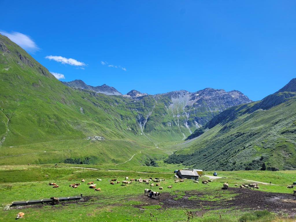
Day 2 started with a long climb out of Les Contamines up to Col du Bonhomme and then onto Col de Croix de la Bonhomme. The trail opens out to Alpine meadows full of wild flowers with the sound of Cowbells accompanying us most of the way up. A brief stop at the top for photos before dropping down into Le Chapieux on a very runnable trail down into the valley.
After a brief stop for lunch, we started the climb up to Col de la Seigne where we would cross over into Italy. The views up the valley were stunning, with the glacial shaping of the valley very evident. Topping out at the Col we could feel the effect of the climb on our legs after a big climbing day. Stopping to admire the view, the thunderstorms returned. This made for a very wet but runnable downhill to our accommodation for the night at Rifugio Elizabetta covering a total of 20.14 miles for the day with 8,278 feet of ascent.
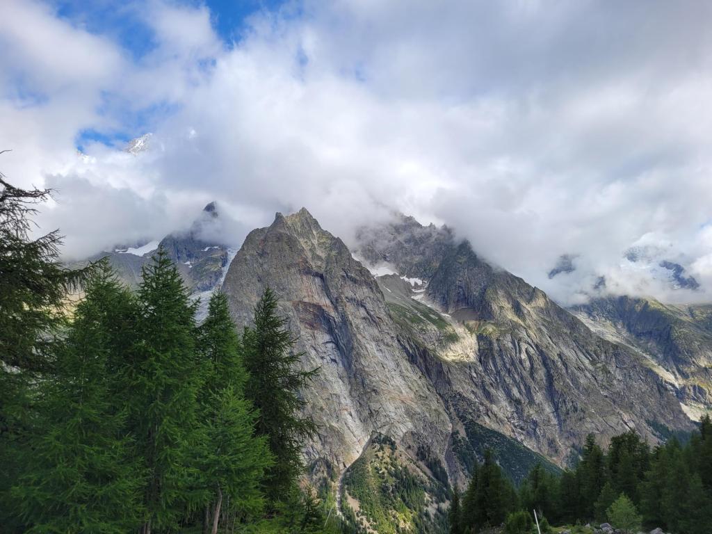
Refugio Elizabetta sits to the side of a glacier and you can see the effects of global warming over the years. 50 years ago the glacier extended all the way to the bottom of the valley, some 2 miles further on, but has shrunk back considerably and was thought provoking.
Day 3 was a shorter day for us, initially dropping down the valley, before climbing over Col Checrouit to drop down on a long descent into Courmayeur. The sun shone and the Alpine valleys were beautiful on the descent, before zigzagging down the forest trails to cover 10.77 miles with 1,916 feet of ascent. The afternoon was spent enjoying some of the Italian hospitality and preparing for the next two days.
Day 4 was my favourite day on the trail and was the hottest day so far. Luckily there were plenty of opportunities to top up water from the glacial streams flowing down the valley.
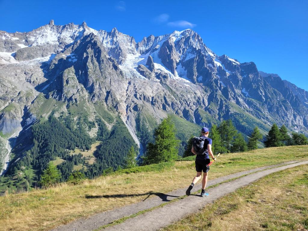
After climbing out of Courmayeur, we ran along the balcony with stunning views of the Mont Blanc massif for the first 10 miles. Dropping down off the balcony, we approach the big climb of the day up the Grand Col de Ferret and the highest point of the trail. This is a short sharp climb for which we were glad of our light packs as we overtook hikers weighed down with what looked like enough provisions to see them out for a year. Cresting the Col, we entered Switzerland and enjoyed running the long descent down into the valley and on to La Fouly. Day four was a total of 19.95 miles with 6,460 feet of ascent.
Day 5 was our longest day, seeing us cover 26.54 miles with 7,218 feet of ascent. Starting at La Fouly we dropped down the valley for the first six miles, making for some easy running miles through forest single track and through several picturesque Swiss villages. We then started the first of three climbs today, up to Col de Champex. This has a beautiful lake, popular for swimming and sailing in the summer, although the overcast cooler conditions meant it was quiet.
After a brief stop in Champex we started the climb up to Col de Portalo, climbing through the forest on a set of switchbacks before finally cresting the shoulder of the Col. From there we dropped down into Trient, through technical single track and some gravity defying walk ways that hang off the side of the mountain.

Topping up our bottles in Trient, we had intended to divert onto the UTMB course across to Vallorcine. However, we had to reroute due to rock falls closing the trail. This meant taking a steeper route up the side of the mountain before rejoining the trail towards the top of the Col. The trail along the top of the ridge to Col du Balme was beautiful with high Alpine meadows and runnable single track. From there we dropped down into Vallorcine and back to our base for the night.
Day six was a shorter day, with only covering 11.9 miles and 3,271 feet of ascent and saw us finishing in Chamonix. First however was the small matter of climbing up to La Flegere via Col du Montets. This was a beautiful but steep climb with amazing views down the valley. It then opened up onto a ridge with some lovely running across to the ski area at La Flegere. From there it is all downhill into Chamonix with some more technical single track before running back into the town, and finishing as we started, in the rain. We celebrated with food and some well-earned drinks before heading back to our apartment to put our feet up.
It is a stunning route and every day seems to surpass the previous day. For those who choose to run this as part of the UTMB series of races, we have the utmost respect. Covering this, non-stop, in under 48 hours is an impressive achievement. Our more leisurely pace allowed us to fully appreciate the views.
